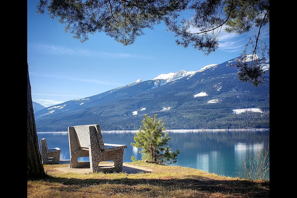
A defining feature of the Kootenays are the Upper and Lower Arrow Lakes, which were made into one big lakemore than 200 kilometres in length by the construction of a dam in the 1960s.
The lakes, in fact, are a widening of the Columbia River, and in this area, the waterway is bordered between the Selkirk Mountains to the east and the Monashee Mountains to the west.
The lake stretches from just north of Castelgar in the southern Kootenays to Revelstoke in the North.
The Arrow Lakes in British Columbia, Canada, divided into Upper Arrow Lake and Lower Arrow Lake, are widenings of the Columbia River. The lakes are situated between the Selkirk Mountains to the east and the Monashee Mountains to the west. Beachland is fairly rare, and is interspersed with rocky headlands and steep cliffs. Mountain sides are heavily forested, and rise sharply to elevations around 2,600 metres.
Two ferries operate on the lake, with the Upper Arrow Lakes Ferry running from Galena Bay to Shelter Bay, and the Needles Cable Ferry on Lower Arrow Lake from Needles on the western shore to Fauquier.
——
See hundreds of photos and articles at westcoasttraveller.com as you plan your next adventure.