The Elk River is an untamed animal, and for some, a ticking time bomb.
‘Fernie hit by worst flooding in 50 years,’ reads the front page of June 14, 1995 edition of The Free Press.
The flood of ‘95 is still fresh in the memory of some, especially those who continue to live on the river.
In the past 20 years, the river has caused over nine acres of Don Caldwell’s land to wash away, the majority of which occurred during those fateful few days, 24 years ago.
Jim Rawson also remembers it well. He is pictured in the June 14, 1995 edition of The Free Press, standing on his property which is covered in water and debris. At one point, the water was up to the windows of his home.
“It got washed away, a lot of it,” said Rawson, 24 years after the event. “The barn went, the rodeo arena I built went, lots of destruction. Never really lost that much, but enough to make it significant.”
A few old Buicks and a Jeep were among the things that washed away, one of which remains in the river.
Before the flood, the family had around 40 acres of land. After, around 31. Eleven was either lost or deemed unusable.
Despite all the destruction, Rawson said it’s a way of life.
“When you live by the river, you just have to expect it,” he said.
(Jim Rawson pictured in The Free Press, after the flood of ‘95.)
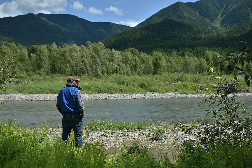
As much as nature is to blame, Hosmer resident Donnie Caldwell said the destruction to his property could have been prevented.
The long-time resident of the area stood on the edge of the river and pointed to the middle of the river, where his property line used to be. To his right are remnants of past flooding events, dozens of dead trees piled up on what is now unusable land.
Caldwell looked up river towards an outcropping of land, and explained that in the mid-80’s, the then Department of Highways, now the Ministry of Transportation and Infrastructure (MOTI) had bought the land and used it as a storage facility for highway gravel.
During the flood of ‘95, he remembers the water taking a large stockpile of gravel from the facility and placing it further down the river, in front of his property. This, he explained, filled the riverbed, raising the river enough to change it’s course, develop a new subsidiary and cut away at his property over time.
The new arm of the river, which has already cut away part of Caldwell’s property in high tide, is visibly lower than the river itself.
(Phil McLachlan/The Free Press)
“The problem is right now… the river current is about four feet higher than what my backwash is. So if it ever breaks through there, down into the backwash, then my farm’s gone. And there’s nothing that they’re going to do about it,” said Caldwell.
In terms of protecting his property, there is little that Caldwell can do himself, other than start the long and very expensive process of applying to construct a dike privately.
Caldwell says he has been told in the past that the Province will not protect farmland.
In the Elk River Flood Mitigation Report commissioned by the RDEK, it explains that “Dikes are generally most suited to address flooding of dense communities where the tax base is sufficient to fund both construction and ongoing maintenance.”
This study is explained in more detail later in this report.
On a property located on a floodplain, one could plan accordingly and build above it, so in the event of a flood, the water will pond and sit under the property. In Caldwell’s case, someone who lives on a flood-torrent, a flooding event would cut through the property, rather than pond on it.
MOTI looked back to the 1980’s and confirmed that the Ministry did purchase the lot in question in 1989, which according to the organization was at the time, located southeast of the highway alignment.
They further explained that the lot is located northwest of the Hosmer Bridge, “likely due to the floods in 1995 and 2013, as well as natural shifts in the river channel and the realignment of the highway for the Hosmer Bridge project in 2002”.
The lot, adjacent to Crown Land, is, according to MOTI, being used publicly for access to launch drift boats in the Elk River.
“Armouring of the bank was carried out as part of the bridge construction in 2002,” said MOTI in their statement. “We have not been able to locate any records indicating a gravel pit usage of the lot.”
The ministry said that while they do not have plans for any works at that location, they would be happy to talk to Mr. Caldwell regarding his concerns.
“Yes, it is a way of life,” said Caldwell. “You’ll get your erosion, but when it was started from a gravel pit, it’s unnecessary erosion.”
(Don Caldwell. Phil McLachlan/The Free Press)
A list of measures has been set in place by Fisheries and Oceans Canada, to “avoid causing serious harm to fish habitat”. These include regulations an individual, when looking to stabilize a bank, cannot temporarily or permanently increase an existing footprint below the high water mark. Also, one cannot add any temporary or permanent fill placed below the high water mark. In short, an individual cannot construct a dike without permission.
On a property located on a floodplain, one can plan accordingly and build above it, so that in the event of a flood, the water will pond and sit under the property. In Caldwell’s case, someone who lives on a flood-torrent, a flooding event would cut through the property, rather than pond on it.
In terms of building something to protect his land, there’s little that Caldwell himself can do, without spending a tremendous amount of money.
(Caldwell stands on what is left of his property. Phil McLachlan/The Free Press)
(A map of the area shows that Caldwell has lost 9.291 acres of land to the Elk River over time. Phil McLachlan/The Free Press)
There have been instances of property owners in the Elk Valley armouring the bank themselves, legitimately, however the cost is significant.
To view a full list of regulations visit Dfo-mpo.gc.ca/pnw-ppe/activities-activites-eng.html.
Over time regulations have become more strict. When Donnie was young, he remembers machines resetting the course of the river by pulling the banks back.
“When I was a kid, there used to be CAT’s in the river steady, a CAT would be in the river. The government would have CAT’s making sure the channel was clean,” said Caldwell.
“I put a permit (application) in to the government to put a CAT in there (the river) and put it back in the channel over here (revert the course of the river) and they wouldn’t allow it,” he continued.
“The fish, oh, we can’t touch the fish,” said Caldwell, imitating a conversation he had a with a government representative.
This story is true for many in the Valley, according to Area A Director Mike Sosnowski.
The local government director said that a good majority of the land in the Elk Valley is either on a 15 per cent hill, or a floodplain. Take that way, he said there’s little left.
“Because we have to live in this place, we mitigate it the best we can,” he said. “You do the best you can.”
That being said, Sosnowski said this is an incredibly difficult and complicated situation in the Elk Valley, as they’re dealing with people, their lives, their properties, and the reality of Mother Nature.
Over and above this, Sosnowski said he’s frustrated by the regulations set in place by the Department of Fisheries and Oceans (DFO).
On June 10, 2019, the RDEK announced that the Hill Road Dike Project would be delayed following notification from the DFO that additional authorizations and design modifications would be required before they would allow the project to move forward.
The DFO’s reasoning for doing so was due to the potential impacts to fish habitat due to the way the project was currently designed.
At the time, Sosnowski publicly expressed his frustration toward the DFO, saying, ‘I am disappointed with DFO’s decision and the delays that it will cause to this project. We recognize the importance of this project to the safety of the residents in the Hill Road area and we will continue to work on a design that meets everyone’s needs.’
The $1.1 million Hill Road Dike Upgrade and Erosion Protection Project (in Cokato) received $750,000 in funding through the Union of BC Municipalities Community Emergency Preparedness Fund, 2018 Structural Flood Mitigation funding stream.
After the flood of 2015, the RDEK received approval from the Province to rebuild the dike as the flood had damaged the riverbank significantly.
Sosnowski said they had all the resources required to complete this project, but the further design work required by the DFO will cause it to be delayed until at least 2020 due to potential design changes, and increased costs associated with this.
“They put the value of that whole community, life and property, they put fish ahead of it,” he said.
“Think of how frustrating it is for the people who live there, that every spring they stand by that river and hope to god that gravel dike holds,” he said.
Sosnowski said he feels as though many of the decisions coming from the federal level are coming from people who have never been close to the community.
“Common sense doesn’t prevail anymore. There’s a total lack of common sense,” he said.
On February 9, 2019 the RDEK received a report regarding Elk River Flood Hazard Mitigation, prepared by Northwest Hydraulic Consultants Ltd.
They commissioned this report to update their 1979 floodplain maps, in order to better understand flood hazard in the East Kootenay region.
Mitigation measures identified in the report include Elk River diking and improvements to tributary channels at the Town of Hosmer, sediment management and improvements in conveyance at Harley Creek, and Elk River diking and new erosion protection downstream of the City of Fernie at Cokato and Riverside.
The proposed cost of dike construction along the Elk River at Hosmer, for the purpose of protecting against through flooding from the Elk River and Mine Creek, was an estimated cost of $2.86M. The downstream Mine Creek conveyance improvement, which is said to widen and deepen the channel through Hosmer, has an estimated cost of $520,000. An upgrade to the existing (downstream, right) bank, which would protect the properties north of Highway 3 downstream of the bridge (an upgrade to current standards) would cost $280,000. A setback to the Hill Road Dike, which would protect existing structure from erosion, as well as homes in the area, is estimated to cost $3.23M.
The Elk River Flood Mitigation Report explains on page 18 (ftp://ftp.rdek.bc.ca/pdf/ElkRiverFloodplainMitigation.R3.pdf) that “Dikes are generally most suited to address flooding of dense communities where the tax base is sufficient to fund both construction and ongoing maintenance.”
To learn more about structural mitigation measures, visit the above link. To learn more about the upstream dike at the Town of Hosmer, visit the above link and scroll to page 30.